Undercover helps you find shaded routes in Singapore

Undercover helps you find shaded routes in Singapore


Singapore is a nation of shelter. Rain or shine, we’re always looking for ways to escape the perils of tropical heat and downpour. This was the driving force behind Undercover, an app developed by a five-person team as part of Hack for Public Good 2026, a hackathon organised by Open Government Products (OGP).

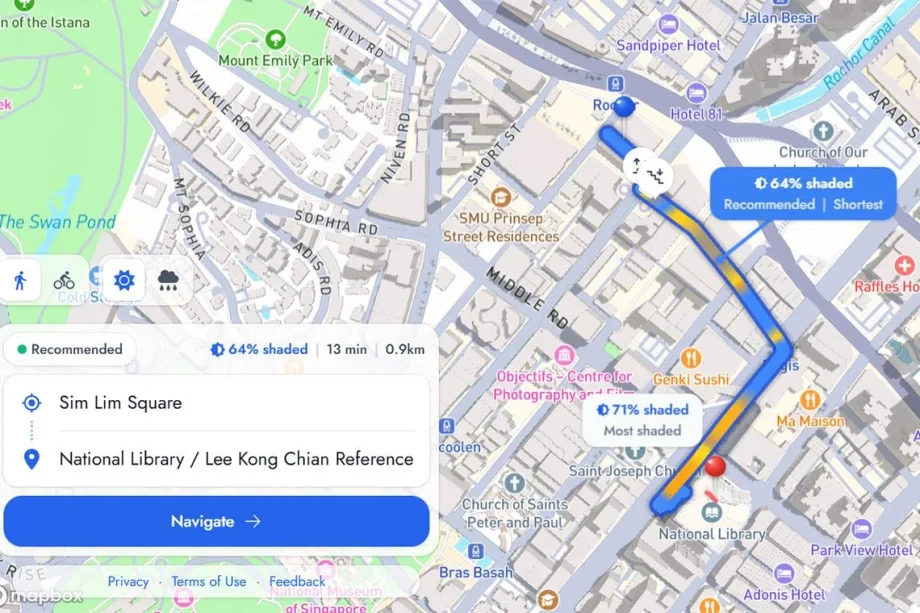
Undercover allows you to find the most covered walking route between two selected locations, making use of not just the over 200km of sheltered walkways in Singapore, but also natural cover.

After determining an optimally covered route, Undercover will show you what percentage of its chosen route is shaded or sheltered, with a yellow-blue gradient showing which parts of the route will be hotter or cooler, respectively.
Undercover Map

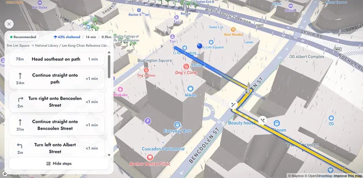
Undercover splits between ‘shaded’ and ‘sheltered’ routes in case of rain, and will provide navigation steps, too.

Photo: HWZ
You might’ve noticed that the app splits its routes between “shaded” and “sheltered” – the former refers to covered paths without a physical shelter, while the latter is meant for routes with an actual roof, for when it rains.

In determining its ‘shaded’ routes, Undercover takes natural cover into account, including shade provided by a building’s shadows. The developers say that this is assisted by building footprint and height data pulled from OpenStreetMap. Using this information, Undercover can determine how much shade a building’s shadows can give based on the month and time of day.

The app also registers lesser-known paths through alleys and HDB neighbourhoods. It’s important to note, too, that Undercover’s covered routes will probably be longer than a route optimised for travel time, given that it’ll show the detours you need to make to stay under shade. 

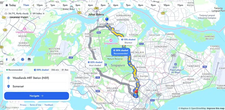
In any case, it’ll give you three kinds of routes – the shortest, the most shaded/sheltered and a recommended one, which finds a reasonably shaded route that isn’t too long. If you’re fortunate, you can end up with a route that meets all three types. And if you’re cycling, the app will also show a route tailored to that, too.

Undercover Map

Undercover is only meant for on-foot travel, so don’t expect it to give you long-distance routes (though maybe a 316-minute walk could be nice?).

Photo: HWZ

One notable limitation is public transport. As it stands, Undercover is meant to be used as a short-distance wayfinder. For instance, it can find the most covered route to a bus stop, but if you need to walk to your destination after alighting, you’ll have to search for that as a separate route, instead of doing the entire journey in one shot.

Undercover is also still being prototyped, so there’s quite a bit missing from the app. The developers are keen on adding tree shade and more accessibility data, alongside improving wayfinding in general. You can try Undercover out here, and provide feedback here.


Read Full Article At Source

Share. Save. Don't Miss The Buzz: XFacebookRedditLINETelegramWhatsAppGmail